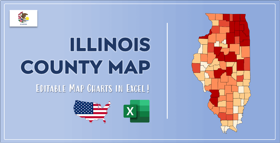

The US state Illinois (IL) is the 6th largest state by population and 25th biggest state by area. Illinois has 102 counties ranking it the 7th state with the most counties in USA. See below some basic information about the state:
| Country: | United States |
| State: | Illinois |
| Abbreviation: | IL |
| Capital: | Springfield |
| Largest City: | Chicago |
| Population: | 12,671,821 |
| Population rank in US: | 6th |
| Total Area [mi²]: | 57,915 |
| Total Area [km²]: | 149,997 |
| Area rank in US: | 25th |
| Number of Counties: | 102 |
If you want to show data distributon per geographical area, density maps (or heat maps) are a great way to achieve this. For example, here is a Illinois Population Density Map per County:
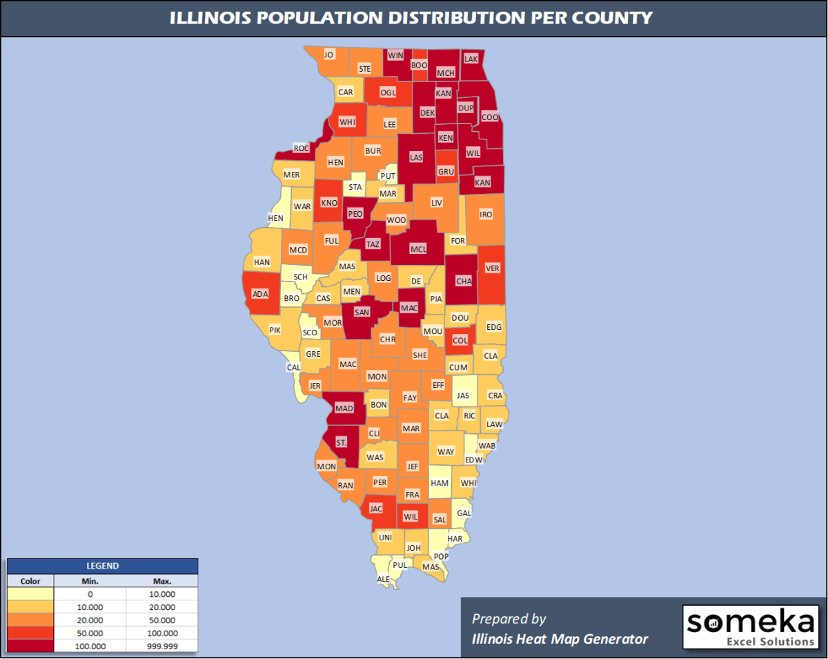
We have prepared this easily with Illinois County Heat Map Generator for population info. But it can also be used for many different data types such as employment rate, average temperature, racial distribution and so on.
Below are 102 Illinois counties ranked by population information. The data is from the US Census Bureau. You can copy and paste this list directly into your spreadsheet.
(Top 10 counties shown. To expand the list, simply click on the “show more” button)
| Rank | County | Population |
|---|---|---|
| 1 | Cook County | 5,150,233 |
| 2 | DuPage County | 922,921 |
| 3 | Lake County | 696,535 |
| 4 | Will County | 690,743 |
| 5 | Kane County | 532,403 |
| 6 | McHenry County | 307,774 |
| 7 | Winnebago County | 282,572 |
| 8 | Madison County | 262,966 |
| 9 | St. Clair County | 259,686 |
| 10 | Champaign County | 209,689 |
| 11 | Sangamon County | 194,672 |
| 12 | Peoria County | 179,179 |
| 13 | McLean County | 171,517 |
| 14 | Rock Island County | 141,879 |
| 15 | Tazewell County | 131,803 |
| 16 | Kendall County | 128,990 |
| 17 | Kankakee County | 109,862 |
| 18 | LaSalle County | 108,669 |
| 19 | DeKalb County | 104,897 |
| 20 | Macon County | 104,009 |
| 21 | Vermilion County | 75,758 |
| 22 | Williamson County | 66,597 |
| 23 | Adams County | 65,435 |
| 24 | Jackson County | 56,750 |
| 25 | Whiteside County | 55,175 |
| 26 | Boone County | 53,544 |
| 27 | Grundy County | 51,054 |
| 28 | Ogle County | 50,643 |
| 29 | Coles County | 50,621 |
| 30 | Knox County | 49,699 |
| 31 | Henry County | 48,913 |
| 32 | Macoupin County | 44,926 |
| 33 | Stephenson County | 44,498 |
| 34 | Franklin County | 38,469 |
| 35 | Woodford County | 38,459 |
| 36 | Jefferson County | 37,684 |
| 37 | Clinton County | 37,562 |
| 38 | Marion County | 37,205 |
| 39 | Livingston County | 35,648 |
| 40 | Monroe County | 34,637 |
| 41 | Fulton County | 34,340 |
| 42 | Lee County | 34,096 |
| 43 | Effingham County | 34,008 |
| 44 | Morgan County | 33,658 |
| 45 | Bureau County | 32,628 |
| 46 | Christian County | 32,304 |
| 47 | Randolph County | 31,782 |
| 48 | McDonough County | 29,682 |
| 49 | Logan County | 28,618 |
| 50 | Montgomery County | 28,414 |
| 51 | Iroquois County | 27,114 |
| 52 | Saline County | 23,491 |
| 53 | Jersey County | 21,773 |
| 54 | Shelby County | 21,634 |
| 55 | Fayette County | 21,336 |
| 56 | Jo Daviess County | 21,235 |
| 57 | Perry County | 20,916 |
| 58 | Douglas County | 19,465 |
| 59 | Crawford County | 18,667 |
| 60 | Hancock County | 17,708 |
| 61 | Edgar County | 17,161 |
| 62 | Warren County | 16,844 |
| 63 | Union County | 16,653 |
| 64 | Bond County | 16,426 |
| 65 | Piatt County | 16,344 |
| 66 | Wayne County | 16,215 |
| 67 | Lawrence County | 15,678 |
| 68 | De Witt County | 15,638 |
| 69 | Pike County | 15,561 |
| 70 | Richland County | 15,513 |
| 71 | Clark County | 15,441 |
| 72 | Mercer County | 15,437 |
| 73 | Moultrie County | 14,501 |
| 74 | Carroll County | 14,305 |
| 75 | Washington County | 13,887 |
| 76 | Massac County | 13,772 |
| 77 | White County | 13,537 |
| 78 | Mason County | 13,359 |
| 79 | Clay County | 13,184 |
| 80 | Greene County | 12,969 |
| 81 | Ford County | 12,961 |
| 82 | Johnson County | 12,417 |
| 83 | Menard County | 12,196 |
| 84 | Cass County | 12,147 |
| 85 | Wabash County | 11,520 |
| 86 | Marshall County | 11,438 |
| 87 | Cumberland County | 10,766 |
| 88 | Jasper County | 9,610 |
| 89 | Hamilton County | 8,116 |
| 90 | Schuyler County | 6,768 |
| 91 | Henderson County | 6,646 |
| 92 | Brown County | 6,578 |
| 93 | Edwards County | 6,395 |
| 94 | Alexander County | 5,761 |
| 95 | Putnam County | 5,739 |
| 96 | Stark County | 5,342 |
| 97 | Pulaski County | 5,335 |
| 98 | Scott County | 4,951 |
| 99 | Gallatin County | 4,828 |
| 100 | Calhoun County | 4,739 |
| 101 | Pope County | 4,177 |
| 102 | Hardin County | 3,821 |
Out of the 102 counties in Illinois, Cook County is the largest by population. McLean County is the largest by land area.
Hardin County is the smallest Illinois county by population. Putnam County is the smallest by size.
In terms of economics and average income level, Lake County is the richest Illinois county.
Alexander County is the poorest Illinois county.
We have prepared Illinois county density map by population as a downloadable PDF.
You can download the PDF for free from the link below:

Illinois County Density Map PDF
Check the video below to see how we use our Illinois County Map Excel Template to visualize any data over Illinois counties.
We have built the easiest Illinois Heat Map Maker in the universe! It works fully in Excel:
Here is a list of useful links which we think can be helpful whether you work on data visualization or make research about Illinois state and Illinois counties.
Data Source for Population and many other US related data:
https://www.census.gov
Wikipedia Page for List of Illinois Counties:
https://en.wikipedia.org/wiki/List_of_counties_in_Illinois
Official Website of the State of Illinois:
https://www2.illinois.gov/
Are you looking for Illinois Zip Code map?:
Illinois Zip Code Heat Map Generator in Excel

