
GENERAL INFO
The US state Washington (WA) is the 13th largest state by population and 18th biggest state by area. Washington has 39 counties ranking it the 33rd state with the most counties in USA. See below some basic information about the state:
| Country: | United States |
| State: | Washington |
| Abbreviation: | WA |
| Capital: | Olympia |
| Largest City: | Seattle |
| Population: | 7,614,893 |
| Population rank in US: | 13th |
| Total Area [mi²]: | 71,362 |
| Total Area [km²]: | 184,827 |
| Area rank in US: | 18th |
| Number of Counties: | 39 |
WASHINGTON COUNTY POPULATION DENSITY MAP
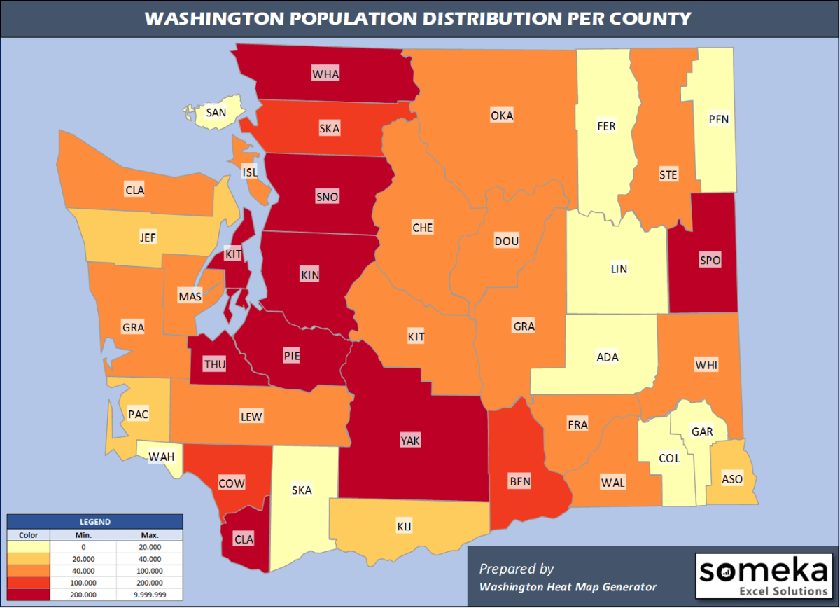
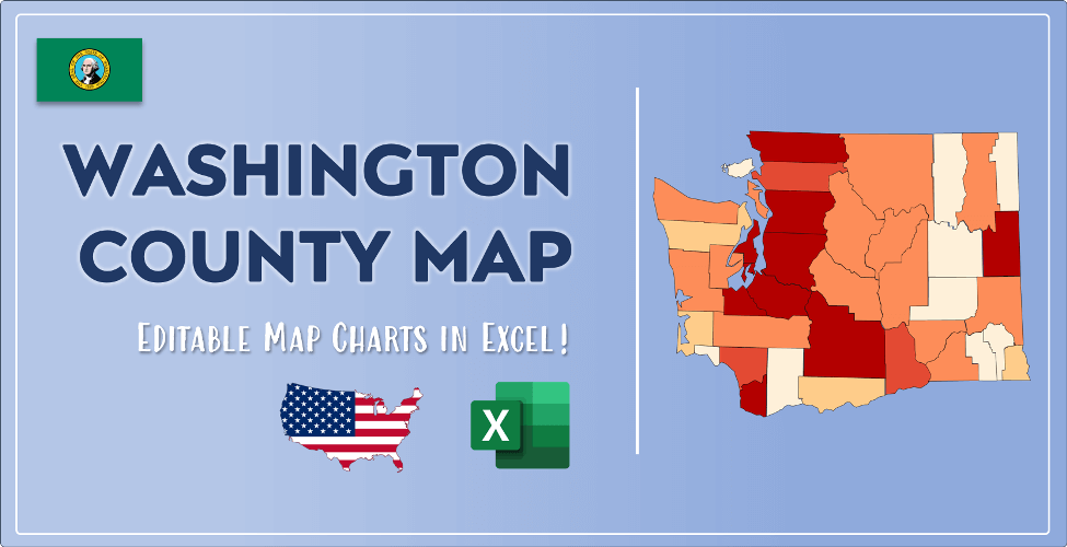
If you want to show data distributon per geographical area, density maps (or heat maps) are a great way to achieve this. For example, here is a Washington Population Density Map per County:
We have prepared this easily with Washington County Heat Map Generator for population info. But it can also be used for many different data types such as employment rate, average temperature, racial distribution and so on.
WASHINGTON COUNTIES LIST
Below are 39 Washington counties ranked by population information. The data is from the US Census Bureau. You can copy and paste this list directly into your spreadsheet.
(Top 10 counties shown. To expand the list, simply click on the “show more” button)
| Rank | County | Population |
|---|---|---|
| 1 | King County | 2,252,782 |
| 2 | Pierce County | 904,980 |
| 3 | Snohomish County | 822,083 |
| 4 | Spokane County | 522,798 |
| 5 | Clark County | 488,241 |
| 6 | Thurston County | 290,536 |
| 7 | Kitsap County | 271,473 |
| 8 | Yakima County | 250,873 |
| 9 | Whatcom County | 229,247 |
| 10 | Benton County | 204,390 |
| 11 | Skagit County | 129,205 |
| 12 | Cowlitz County | 110,593 |
| 13 | Grant County | 97,733 |
| 14 | Franklin County | 95,222 |
| 15 | Island County | 85,141 |
| 16 | Lewis County | 80,707 |
| 17 | Clallam County | 77,331 |
| 18 | Chelan County | 77,200 |
| 19 | Grays Harbor County | 75,061 |
| 20 | Mason County | 66,768 |
| 21 | Walla Walla County | 60,760 |
| 22 | Whitman County | 50,104 |
| 23 | Kittitas County | 47,935 |
| 24 | Stevens County | 45,723 |
| 25 | Douglas County | 43,429 |
| 26 | Okanogan County | 42,243 |
| 27 | Jefferson County | 32,221 |
| 28 | Asotin County | 22,582 |
| 29 | Pacific County | 22,471 |
| 30 | Klickitat County | 22,425 |
| 31 | Adams County | 19,983 |
| 32 | San Juan County | 17,582 |
| 33 | Pend Oreille County | 13,724 |
| 34 | Skamania County | 12,083 |
| 35 | Lincoln County | 10,939 |
| 36 | Ferry County | 7,627 |
| 37 | Wahkiakum County | 4,488 |
| 38 | Columbia County | 3,985 |
| 39 | Garfield County | 2,225 |
FREQUENTLY ASKED QUESTIONS ABOUT WASHINGTON COUNTIES
What is the largest county in Washington?
Out of the 39 counties in Washington, King County is the largest by population. Okanogan County is the largest by land area.
What is the smallest county in Washington?
Garfield County is the smallest Washington county by population. Garfield County is the smallest by size.
What is the richest county in the state of Washington?
In terms of economics and average income level, King County is the richest Washington county.
What is the poorest county in Washington?
Adams County is the poorest Washington county.
WASHINGTON COUNTIES MAP PDF
We have prepared Washington county density map by population as a downloadable PDF.
You can download the PDF for free from the link below:

Washington County Density Map PDF
VIDEO: HOW TO PAINT WASHINGTON COUNTY MAP WITH YOUR DATA
Check the video below to see how we use our Washington County Map Excel Template to visualize any data over Washington counties.
CREATE YOUR WASHINGTON DENSITY MAP IN 3 STEPS!
We have built the easiest Washington Heat Map Maker in the universe! It works fully in Excel:
LINKS AND RESOURCES
Here is a list of useful links which we think can be helpful whether you work on data visualization or make research about Washington state and Washington counties.
Data Source for Population and many other US related data:
https://www.census.gov
Wikipedia Page for List of Washington Counties:
https://en.wikipedia.org/wiki/List_of_counties_in_Washington
Official Website of the State of Washington:
https://access.wa.gov/
Are you looking for Washington Zip Code map?:
Washington Zip Code Heat Map Generator in Excel
