

The US state Wisconsin (WI) is the 20th largest state by population and 23rd biggest state by area. Wisconsin has 72 counties ranking it the 19th state with the most counties in USA. See below some basic information about the state:
| Country: | United States |
| State: | Wisconsin |
| Abbreviation: | WI |
| Capital: | Madison |
| Largest City: | Milwaukee |
| Population: | 5,822,434 |
| Population rank in US: | 20th |
| Total Area [mi²]: | 65,498 |
| Total Area [km²]: | 169,640 |
| Area rank in US: | 23rd |
| Number of Counties: | 72 |
If you want to show data distributon per geographical area, density maps (or heat maps) are a great way to achieve this. For example, here is a Wisconsin Population Density Map per County:
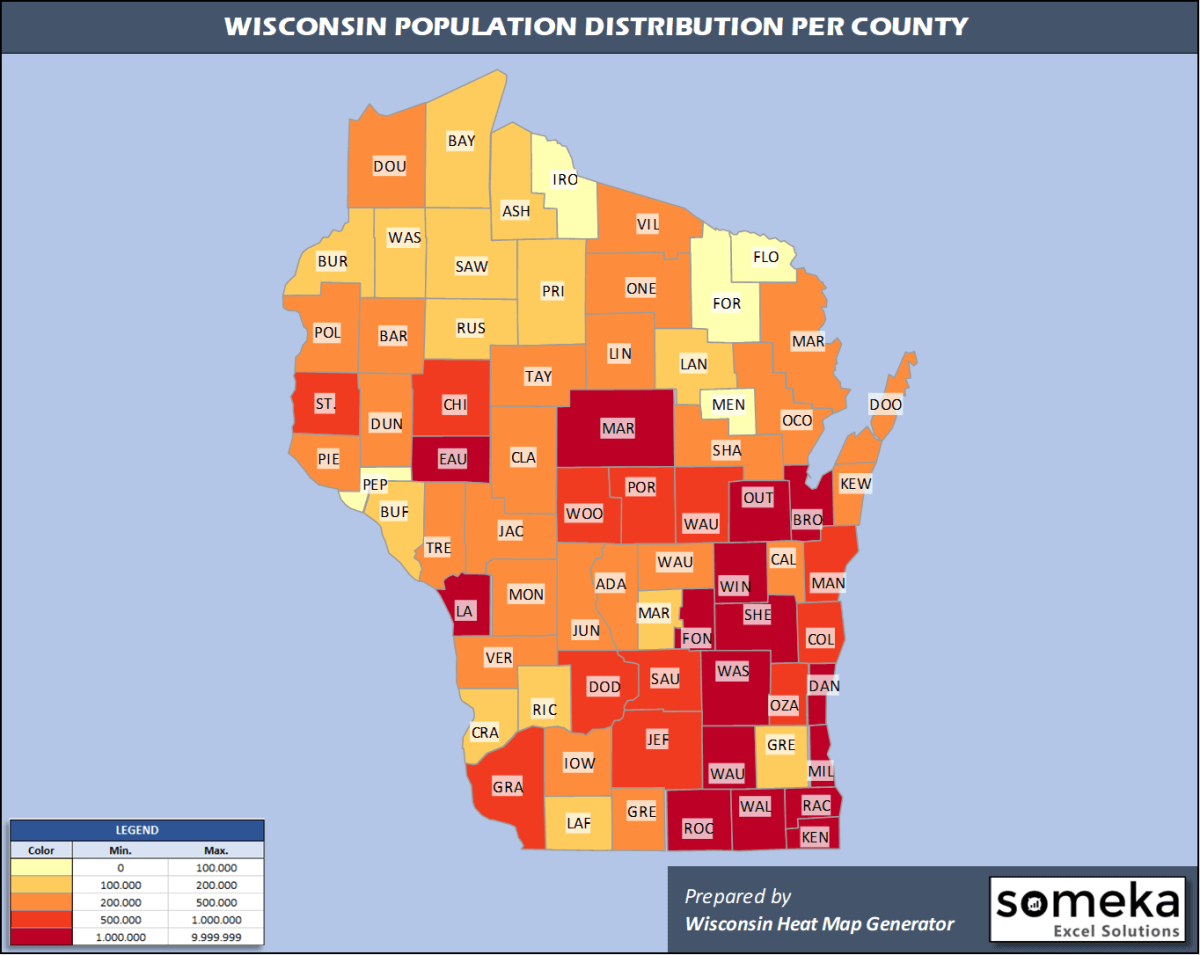
We have prepared this easily with Wisconsin County Heat Map Generator for population info. But it can also be used for many different data types such as employment rate, average temperature, racial distribution and so on.
Below are 72 Wisconsin counties ranked by population information. The data is from the US Census Bureau. You can copy and paste this list directly into your spreadsheet.
(Top 10 counties shown. To expand the list, simply click on the “show more” button)
| Rank | County | Population |
|---|---|---|
| 1 | Milwaukee County | 945,726 |
| 2 | Dane County | 546,695 |
| 3 | Waukesha County | 404,198 |
| 4 | Brown County | 264,542 |
| 5 | Racine County | 196,311 |
| 6 | Outagamie County | 187,885 |
| 7 | Winnebago County | 171,907 |
| 8 | Kenosha County | 169,561 |
| 9 | Rock County | 163,354 |
| 10 | Washington County | 136,034 |
| 11 | Marathon County | 135,692 |
| 12 | La Crosse County | 118,016 |
| 13 | Sheboygan County | 115,340 |
| 14 | Eau Claire County | 104,646 |
| 15 | Walworth County | 103,868 |
| 16 | Fond du Lac County | 103,403 |
| 17 | St. Croix County | 90,687 |
| 18 | Ozaukee County | 89,221 |
| 19 | Dodge County | 87,839 |
| 20 | Jefferson County | 84,769 |
| 21 | Manitowoc County | 78,981 |
| 22 | Wood County | 72,999 |
| 23 | Portage County | 70,772 |
| 24 | Chippewa County | 64,658 |
| 25 | Sauk County | 64,442 |
| 26 | Columbia County | 57,532 |
| 27 | Grant County | 51,439 |
| 28 | Waupaca County | 50,990 |
| 29 | Calumet County | 50,089 |
| 30 | Monroe County | 46,253 |
| 31 | Dunn County | 45,368 |
| 32 | Barron County | 45,244 |
| 33 | Polk County | 43,783 |
| 34 | Douglas County | 43,150 |
| 35 | Pierce County | 42,754 |
| 36 | Shawano County | 40,899 |
| 37 | Marinette County | 40,350 |
| 38 | Oconto County | 37,930 |
| 39 | Green County | 36,960 |
| 40 | Oneida County | 35,595 |
| 41 | Clark County | 34,774 |
| 42 | Vernon County | 30,822 |
| 43 | Trempealeau County | 29,649 |
| 44 | Door County | 27,668 |
| 45 | Lincoln County | 27,593 |
| 46 | Juneau County | 26,687 |
| 47 | Waushara County | 24,443 |
| 48 | Iowa County | 23,678 |
| 49 | Vilas County | 22,195 |
| 50 | Jackson County | 20,643 |
| 51 | Kewaunee County | 20,434 |
| 52 | Taylor County | 20,343 |
| 53 | Adams County | 20,220 |
| 54 | Langlade County | 19,189 |
| 55 | Green Lake County | 18,913 |
| 56 | Richland County | 17,252 |
| 57 | Lafayette County | 16,665 |
| 58 | Sawyer County | 16,558 |
| 59 | Crawford County | 16,131 |
| 60 | Washburn County | 15,720 |
| 61 | Marquette County | 15,574 |
| 62 | Ashland County | 15,562 |
| 63 | Burnett County | 15,414 |
| 64 | Bayfield County | 15,036 |
| 65 | Rusk County | 14,178 |
| 66 | Price County | 13,351 |
| 67 | Buffalo County | 13,031 |
| 68 | Forest County | 9,004 |
| 69 | Pepin County | 7,287 |
| 70 | Iron County | 5,687 |
| 71 | Menominee County | 4,556 |
| 72 | Florence County | 4,295 |
Out of the 72 counties in Wisconsin, Milwaukee County is the largest by population. Marathon County is the largest by land area.
Florence County is the smallest Wisconsin county by population. Ozaukee County is the smallest by size.
In terms of economics and average income level, Ozaukee County is the richest Wisconsin county.
Menominee County is the poorest Wisconsin county.
We have prepared Wisconsin county density map by population as a downloadable PDF.
You can download the PDF for free from the link below:

Wisconsin County Density Map PDF
Check the video below to see how we use our Wisconsin County Map Excel Template to visualize any data over Wisconsin counties.
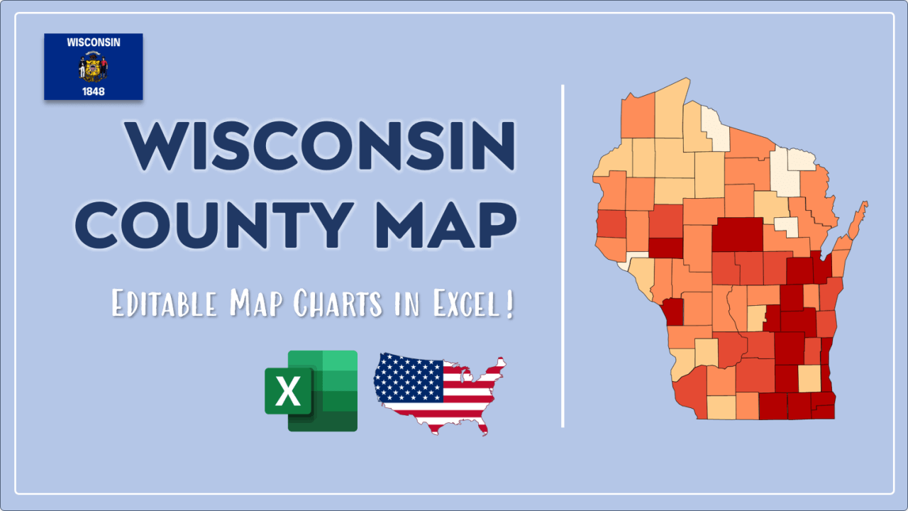
We have built the easiest Wisconsin Heat Map Maker in the universe! It works fully in Excel:
Here is a list of useful links which we think can be helpful whether you work on data visualization or make research about Wisconsin state and Wisconsin counties.
Data Source for Population and many other US related data:
https://www.census.gov
Wikipedia Page for List of Wisconsin Counties:
https://en.wikipedia.org/wiki/List_of_counties_in_Wisconsin
Official Website of the State of Wisconsin:
https://www.wisconsin.gov
Are you looking for Wisconsin Zip Code map?:
Wisconsin Zip Code Heat Map Generator in Excel

