Europe Geographic Heat Map Generator Excel Template
Europe Heat Map Excel Template for Europe countries. Just put your data, set your colors and create Heat Map of Europe in seconds!
TEMPLATE DESCRIPTION
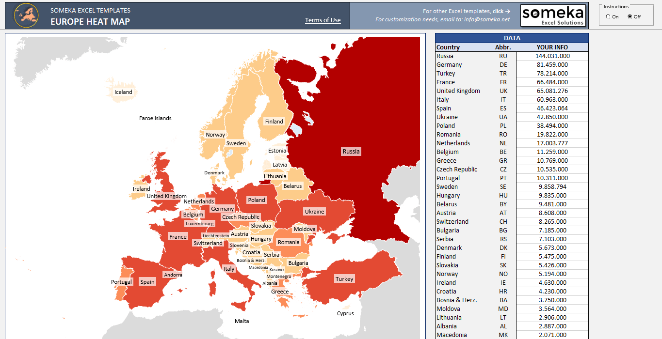
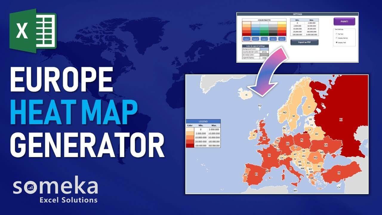
Using heat maps is an efficient method of data visualization. Color sets are used to represent graphically, the values of individual data points in a set of data. Accordingly, the most commonly used form is “geographical heat maps”. Typically, professions like meteorology, politics, sociology, and economy use it. What about creating a Europe Heat Map with country population data in Excel?
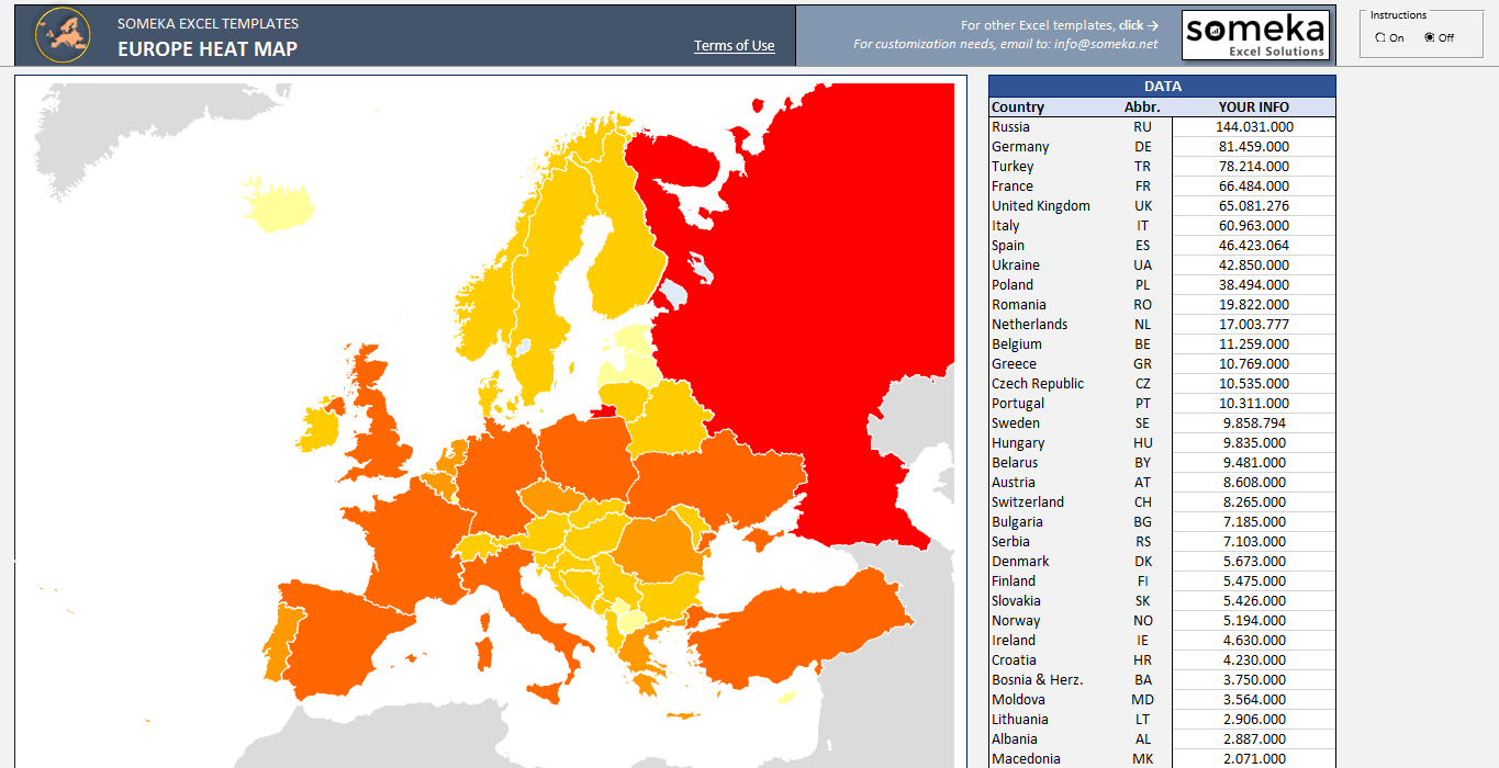
Simply, it will look like this:
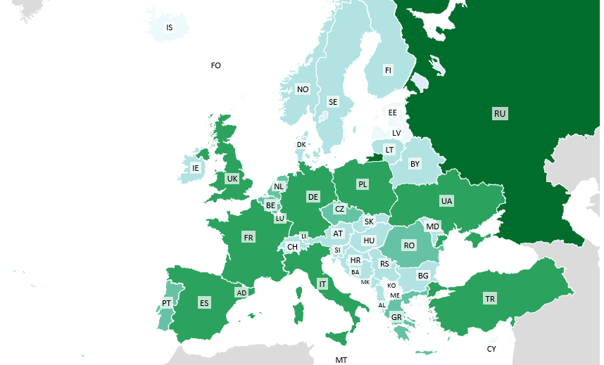
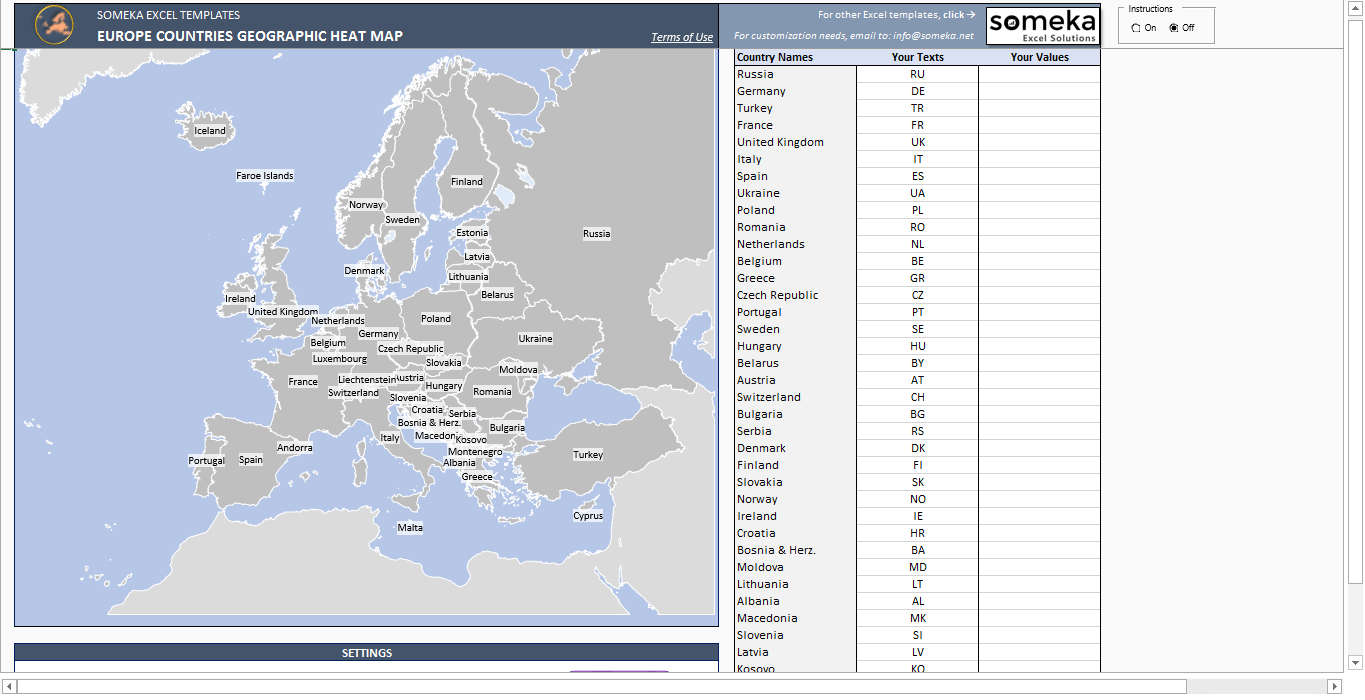
However, creating a choropleth map from scratch is not that easy. Therefore, Someka offers a pre-made template in Excel which includes 45 countries in Europe Continent inside.
Europe Heat Map Generator perfectly works with your data in Excel!
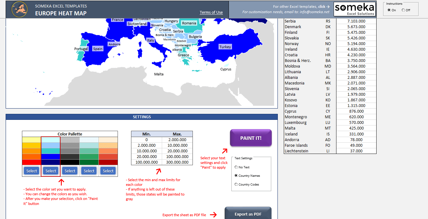
Thanks to this Excel template, basically you will create density maps in 3 steps:
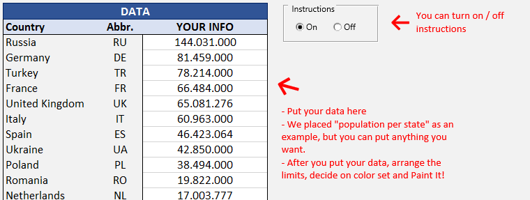
1. Step: Paste/Type your data from your own spreadsheet
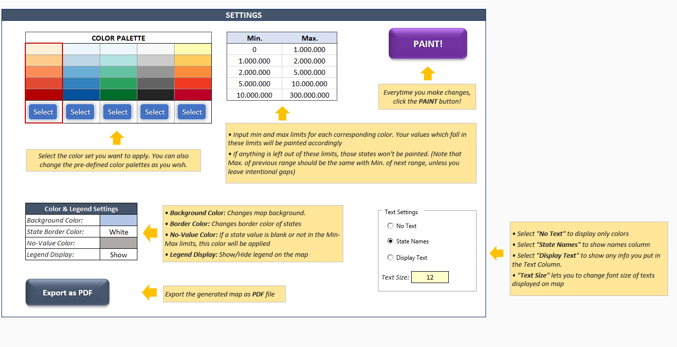
2. Step: Choose your limits for data ranges
3. Step: Choose your color set and click the button!
Creating a Geo Heat Map has never been this simple!
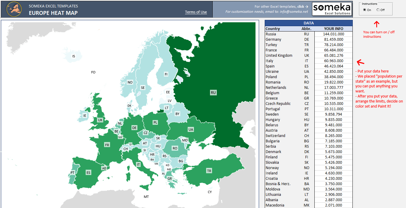
In addition, on-sheet instructions will ease and clarify the usage of the template:
Since this Europe heat map template is print-ready, you can easily print it. Also, you can easily export it to PDF if you like.
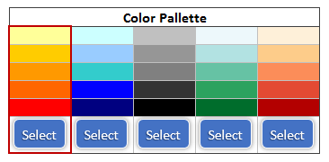
To clarify, you can pick one of 5 different color set options or change the colors to create a colored map of Europe!
Finally, discover more about our whole collection at Someka Heat Map Generators in order not to skip heat maps of other continents, the whole world, and countries like the USA, UK, Canada, China, Japan, and Turkey.
Europe Geographic Heat Map Generator Features Summary:
- Fully Editable Europe map with also 45 countries
- Colored Map of Europe
- Easy to use and nice design
- 5 Premade color sets to choose from (you can even modify as you wish)
- Export to PDF feature
- Clear on sheet instructions (with turn on/off function)
- Print Ready
- Works on both Windows and Mac
- Compatible with Excel 2007 and later
- No installation needed. Ready to use.
PRODUCT VIDEO
Watch the video below to see the template in action! Presentation also includes usage notes, explanations and tips & tricks about the template.
USER REVIEWS & COMMENTS
20 reviews for Europe Geographic Heat Map Generator Excel Template
You must be logged in to post a review.
RELATED TEMPLATES
-
 This product has multiple variants. The options may be chosen on the product page
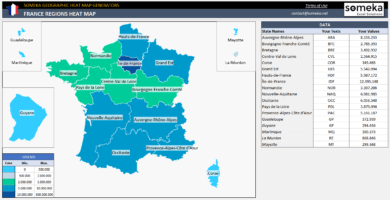
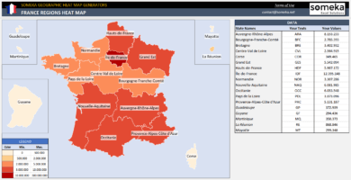
France Geographic Heat Map Generator Excel Template
$0.00 – $59.95Excel Heat Map Generator to paint France provinces automatically according to your data. Make inputs in Excel and your geo heat map created instantly.
-
This product has multiple variants. The options may be chosen on the product page
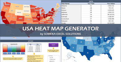
US Geographic Heat Map Generator Excel Template
$0.00 – $79.95Easy to use Heat Map Excel Template for US states. Just put your data and your printable Geographic Heat Map will be generated automatically.
-
This product has multiple variants. The options may be chosen on the product page
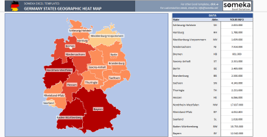
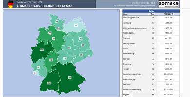
Germany Geographic Heat Map Generator Excel Template
$0.00 – $59.95Unique Excel Template to Make Dynamic Germany Heat Map at Region Level. Enter your data in Excel and your heat map gets created instantly.
-
This product has multiple variants. The options may be chosen on the product page
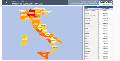
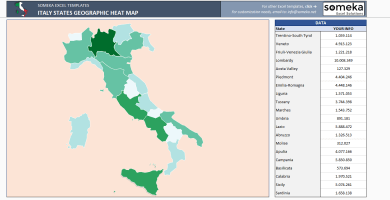
Italy Geographic Heat Map Generator Excel Template
$0.00 – $59.95Unique Excel Template to make dynamic Italy Heat Map at region level. Enter your own data in the template and heat map gets ready automatically.
-
This product has multiple variants. The options may be chosen on the product page
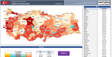
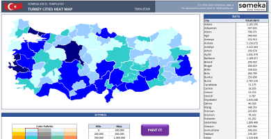
Turkey Geographic Heat Map Generator Excel Template
$0.00 – $59.95Unique Excel Template to create Turkey Heat Map. Just put your data and your printable density map will be generated automatically.
-
This product has multiple variants. The options may be chosen on the product page
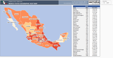
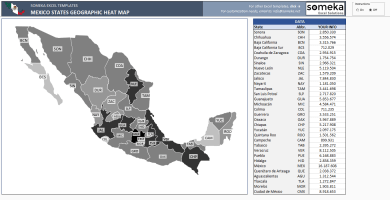
Mexico Geographic Heat Map Generator Excel Template
$0.00 – $59.95Dynamic Excel Template to create Mexico Heat Map automatically at state level. Enter your data in the template and heat map gets ready instantly.

Hakan –
Very easy to use, definitely recommend!
Marco Aisa –
Thank you for adding color option, so handy to make it customise to my need
Katie Robertz –
Easy to use, love clear directions!
Mohammad Norozi –
Saves a ton of hours if you’re planning on making your own.
Barry –
Great!
Berto –
nice and want to change my license to multiuser. to share with my team member. Pls help
Someka –
Hello Berto,
We may surely upgrade your license from single-user to multi-user. Just email us at contact@someka.net and our team will contact you with a link to upgrade your license.
Wapasha –
Great excel. Visualizng my data is very cool with this
Maynard –
thx for five different color options someka
Keith2unurn –
Great
bellefaith –
Hello, I am a new user and I would like to ask you, How to disable the texts on map?
Someka –
Hello there,
Please follow these steps to hide the texts on the map. Select No Text option > Click Paint!
Terrybuh –
Very interesting to read you
Good luck to you
Marcus –
Loved this Heat Map! Excellent web site. A lot of helpful information here.
bellefaith –
Hello i am new user and i would to ask you, How to disable avatar?
Someka –
Hello there!
In order to remove the logo and add yours, just unprotect your sheet with the password which is provided in the ZIP file.
For a further explanation check this guide: Can I remove your logo and insert mine?
Anale S. –
Pretty! This has been a really wonderful post. Many thanks for supplying this info.
Alle P. –
Spot on with this write-up, I seriously believe that this amazing site needs much more attention. I’ll probably be back again to see more, thanks for the advice!
DanielEralm –
Thank you for helping people get the information they need. Great stuff as usual. Keep up the great work!!!
Javch5 –
Really good design, i’ve already used it but you might add geographic shapes by zip codes as well. That would be demanded more.
Someka –
Thank you! We’ve not provided zip codes option because zip code as it is quite small and impractical to apply.
stephen_pobon –
Thank you so much for your great instruction but is there any way to further extend this heat map to give more color options? I would be able to type, for example different colors?
Someka –
Thanks for your feedback Stephen! For different colors, all you need to do is edit the fill color within the Legend by formatting the cells.
carneydigital –
This spreadsheet was helpful for my project. By the way, why you don’t produce heat map for Belgium? That would be great
Someka –
Thanks for feedback Marisa! We keep adding new country heat maps from time to time.
Don’t forget to subscribe our newsletter and hear the new templates as soon as they are announced!
Cora Adraoui –
I developed a gender education statistics heat map for Texas and Alabama separately. This template was not only formatted very professionally but it is also very customizable to my data, which is so so great!